


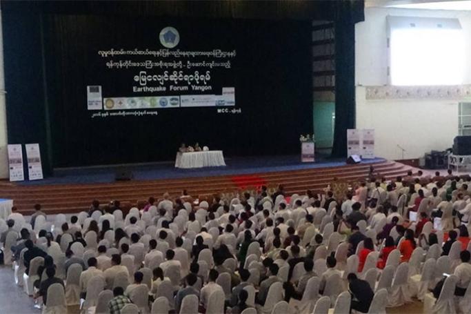
The impending threat of a large earthquake devastating Myanmar's major cities has galvanised government agencies, INGOs and CSOs into action, with a landmark meeting taking place on October 8 in Yangon.
ActionAid Myanmar organized the Earthquake Forum Yangon on earthquake preparedness and the response capacity of Yangon with the guidance of Ministry on Social Welfare, Relief and Resettlement and the Yangon regional Government.
Representatives of government ministries, the military, UN agencies, NGOs and community organisations have begun coordinating in order to prepare for the inevitable quakes which rattle Myanmar’s commercial capital and elsewhere in the country.
Several fault lines run through Myanmar.
Preparation is key to minimising the loss of life, the Union Minister for Social Welfare, Relief and Resettlement Dr Win Myat Aye told the audience at the conference.
“For those who know what to do and what not to do, it is highly likely that their lives can be saved,” he said, underscoring the seriousness of the threat posed.
This comes in the wake of the recent 6.8-magnitude tremblor that hit Chauk in central Myanmar, killing four people and causing significant damage to some 400 temples in Bagan. It was felt as far afield as Bangkok and Dhaka, and shook the top off a temple in Rakhine State's Mrauk U.
The October 8 conference marks the beginning of interagency cooperation with government and the military on disaster preparedness.
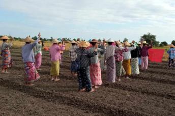
“Myanmar is very prone to all kind of disaster,” Dr Win Myat Aye said. “We need to raise awareness of the people regarding disasters and encourage them to participate in earthquake preparation activities.”
Thura Aung of the Myanmar Earthquake Committee pointed to fears that a major seismic event is very much on the cards. The recurrence interval (RI), or the amount of time typically elapsed between earthquakes of a certain magnitude, can be used to roughly predict when a tremblor can be expected. The RI on a quake of 7.0 has been calculated at 60 to 70 years, he said.
“Seismologists fear the RI is not correct,” he said. “Once it happens it will be more devastating and [there could be] major loss of life. If earthquakes do not happen at regular intervals, it will be more and more devastating.”
The greatest loss of life from an earthquake in Myanmar was in 1930, when a magnitude 7.0 earthquake killed 500 people in Bago Region, and 50 in Yangon. At the time, Yangon's population was just 400,000. The city's population has since ballooned to around 6 million, and has undergone rapid transformation and a construction boom.
Construction regulation is a key issue. Many of the city's poorly-constructed buildings do not meet basic earthquake protocol. Around 17% of dwellings in Yangon are multi-storey apartment complexes. Around 28% of schools in the region require major upgrades, with 44% in need of minor adjustments.
“Yangon city lies very close to the Sagaing Fault. We cannot change that … but we can build resistant buildings [and promote awareness],” said the Myanmar Engineering Society's Saw HtweZaw.
The city's decrepit sewerage and drainage infrastructure already struggles to cope with monsoonal downpours, which regularly causes flooding – a fact Saw HtweZaw says can affect the foundations of newer buildings.
Yangon City Development Council's Hnin Ei Win says there are plans in the works to cater for temporary shelter in the event of a major earthquake. In the immediate future, however, vulnerability assessments are being carried out across the city. A pilot programme has been rolled out in the downtown Kyauktada Township, where over 300 buildings were constructed prior to 1980 and thus are unlikely to meet earthquake regulations.
Public awareness projects in Pazundaung and Tamwe are not yet completed, she said. YCDC is rolling out an in-school programme that will see students taught what to do in the event of an earthquake. YCDC says it is hoped they will pass on this knowledge to their friends and relatives.
The Yangon Region Health Services Department is also in the process of preparing to respond to mass casualties. Yangon has four district hospitals, and 19 township hospitals. Specialist units are being briefed on dealing with disease control, should a major catastrophe occur.
“Since 2014 we have developed a hospital emergency plan,” said a representative of the Department of Medical Services, Yangon Region.
Tatmadaw Professor Colonel Khin Aung Htun said the military stands ready to carry out rescue and relief efforts. He said that, since 2010, the Military has been involved in recovery efforts following natural disasters – the first major operation being Cyclone Giri in 2010.
He said military hospitals will open their doors to treat disaster-affected people, bolstering the state health effort.
“Our main purpose is to save as many lives as we can,” he said, outlining the Tatmadaw's triage plan. Military resources would be deployed for any necessary evacuations, with aircraft and boats ready to deliver relief supplies. As in the wake of 2015's Cyclone Komen, the Tatmadaw would also deliver water and sanitation aid.
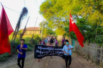
Myanmar Red Cross Society's disaster management programme coordinator Aung Naing Lwin says his organisation is developing awareness programmes in schools, ensuring that drills are carried out so students know how to respond.
In the event of a major earthquake, he said, people could turn to their social media channels in order to receive updates, information and advice. MRCS has done a deal with telecommunications company Ooredoo to provide free SMS alerts to subscribers, and talks with Telenor and MPT are reportedly in the works.
Experts have cautioned on the need for disaster preparedness for some time.
"If a big earthquake happened to one big city, that would be very devastating because they are not very prepared," an earthquake expert at the Asia Disaster Preparedness Center (ADPC) in Bangkok told IRIN News in 2011, citing poor construction quality.
New research has brought to light the possibility of significant seismic activity along a “megathrust fault” that lies under Myanmar, Bangladesh and India – something experts have cautioned has the potential to bring about a 9.0-magnitude event.
The more immediate threat, however, lies with the Sagaing fault, which stretches some 1,000 kilometres from northern Myanmar to the Gulf of Mottama. It is the most active fault in the country, along which the country's two most developed cities lie.
Myanmar is particularly earthquake-prone, and has had 30 sizeable earthquakes in the past year according to the United States Geological Survey.
In 2011, a 6.8 magnitude quake was centred in eastern Shan State and the death toll was estimated at around 80 people. In 2012, the Thabiekyin 6.8 magnitude quake, caused by the Sagaing Fault, struck an area about 100 kms north of Mandalay. An estimated 26 people died and significant damage occurred.
Fears of a serious quake prompt landmark NGO and local govt preparedness forum